Subdivision layout design best practices are not optional guidelines; ignoring them is exactly like trying to assemble a Swedish flat-pack shed without looking at the manual. My neighbor spent three hours last Saturday unpacking boxes on his driveway, grabbing his power drill, and sinking screws into whatever pieces looked like they fit together. By noon, he had a structure that resembled a tilted trapezoid, three leftover aluminum brackets, and a door that wouldn’t close. He blamed the manufacturer. I just drank my coffee and watched the wind slowly push the whole thing over. People love ignoring the instructions because they think their raw intuition is somehow superior to established geometry.
Which brings me to the absolute garbage heap of residential plats piling up on the desks of municipal zoning administrators across Wisconsin.
Developers keep buying forty acres of rolling farmland and instantly handing it over to a CAD technician who just slaps a straight-line grid over the topography. They cram as many seventy-foot lots as mathematically possible into the boundaries, draw a single cul-de-sac, and demand village approval. Then they act shocked when the plan commission tears the proposal to shreds during the first public hearing.
If you want to get a project out of the ground, you have to follow subdivision layout design best practices. You cannot bully a local zoning board into accepting a layout that violates their municipal master plan.
The Brutal Reality of Subdivision Layout Design Best Practices
A spreadsheet does not dictate good land planning. Your pro forma might say you need sixty units to make the bank loan work, but the local zoning code does not care about your debt service coverage ratio. Zoning codes exist to prevent developers from building tightly packed, unlivable concrete jungles that drain municipal resources. Implementing subdivision layout design best practices means accepting that the physical dirt dictates the lot count.
When you submit a preliminary plat, the local planning department is looking at right-of-way widths, corner lot visibility triangles, and setback requirements. They are looking at how your new street connects to the existing county highway. If your entrance creates a blind intersection because you refused to sacrifice one buildable lot to create a proper sightline, the city engineer will reject it.
If developers think ignoring the municipal code will speed up the approval process, there making a massive mistake.
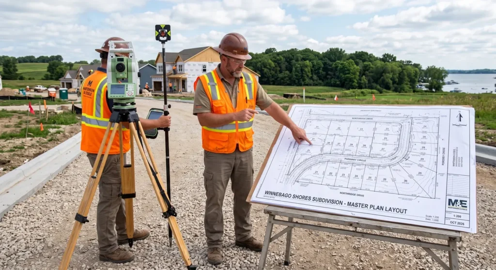
You need a team that reads the local ordinances before drawing a single property line. Our planning and municipal zoning advisory services exist specifically to bridge the gap between developer ambition and municipal reality. We look at the zoning map. We read the future land use plans. If the village wants medium-density residential with dedicated parkland, we do not waste everyone’s time submitting a high-density townhome layout.
Why Grid Patterns Violate Subdivision Layout Design Best Practices
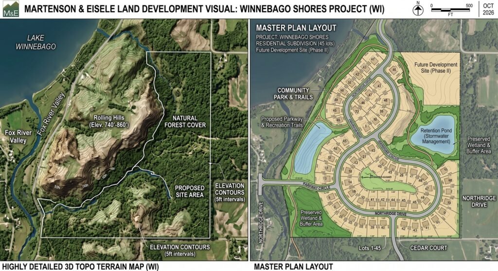
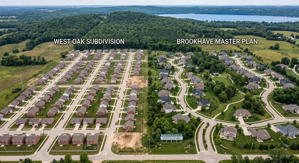
Throwing a rigid grid pattern over a piece of raw Wisconsin land is lazy planning. Our state has kettles, moraines, wetlands, and heavy tree lines. A residential plat that respects the natural topography sells faster and commands higher lot premiums.
When you follow actual subdivision layout design best practices, you design curvilinear streets that slow down neighborhood traffic naturally. You avoid the traps that enrage plan commissions. Here is what municipal planning directors actually expect to see on your submittal:
- Adequate Street Connectivity: Stop designing massive subdivisions with only one point of ingress and egress. Fire chiefs hate it, and plan commissions will block it. Subdivision layout design best practices demand secondary access points.
- Avoidance of Double-Frontage Lots: Nobody wants a house sandwiched between two busy streets. Good planning uses buffers, berms, and strategic lot depths to shield homeowners from arterial traffic.
- Usable Open Space: A swampy, unbuildable corner of your parcel does not count as a “park.” Municipalities want active, accessible green space dedicated to the public, not just leftover scraps of undevelopable dirt.
- Logical Phasing: Do not present a massive five-phase plat if phase one doesn’t function independently. Every phase must have adequate temporary turnarounds for snowplows and emergency vehicles.
The Zoning Variance Trap
The quickest way to get an entire neighborhood screaming at you during a Tuesday night public hearing is to submit a layout that requires six different zoning variances.
Developers love variances. They view them as a magic wand to fix their terrible lot geometry. Plan commissions hate variances. They view them as a failure of planning. A variance is legally supposed to be a remedy for an extreme, unique hardship inherent to the land itself, not a get-out-of-jail-free card because you want to squeeze an extra duplex onto a corner lot.
When you present a layout riddled with setback encroachments and undersized lot widths, you immediately put the zoning board on the defensive. You force them to justify breaking their own rules to an audience of angry citizens. They will not do it. They will table your application, demand a complete redesign, and push your timeline back by three months.
We design plats that conform to the code. We might negotiate on planned unit development (PUD) overlays, but we do not walk into a village hall asking for arbitrary favors. We walk in with a master plan that meets the exact letter of the municipal ordinance because that is the core of subdivision layout design best practices. It removes the friction. It takes away the neighbors’ ammunition.
Defending Your Layout with Subdivision Layout Design Best Practices
Neighbors hate new development. It is a fundamental law of real estate. They will pack the municipal hall and complain about traffic, noise, and neighborhood character.
Your only defense against NIMBYism is an airtight layout. When an angry resident stands up at the microphone and claims your new street will cause traffic accidents, our planners stand up and point to the traffic calming curves and perfectly executed intersection radii that meet every local and state standard. When they complain about environmental impact, we pull up the Wisconsin DNR wetland buffers we clearly mapped and respected.
We win these fights by being over-prepared and entirely compliant.
Stop fighting the zoning administrators. Stop trying to shoehorn sixty lots onto a parcel meant for forty. Hire a firm that understands how to negotiate with municipalities, read a master plan, and design a residential neighborhood that people actually want to live in. Bring your land to Martenson & Eisele, and we will get your plat approved without the circus.
Frequently Asked Questions
What are the core components of subdivision layout design best practices?
Good layout design prioritizes safe traffic flow, proper lot orientation to maximize solar exposure and topography, strict adherence to municipal zoning setbacks, and the integration of usable open spaces. True subdivision layout design best practices avoid rigid grids in favor of street patterns that naturally fit the land’s contours.
Why do plan commissions reject preliminary residential plats?
Plats are typically rejected because they violate existing zoning ordinances, lack secondary emergency access routes, propose undersized lots, or fail to align with the municipality’s long-term master plan for future land use. Relying heavily on zoning variances instead of following subdivision layout design best practices is the most common reason for rejection.
How does a Planned Unit Development (PUD) impact subdivision layouts?
A PUD is a customized zoning tool that allows developers to negotiate flexible lot sizes, setbacks, and mixed uses in exchange for providing superior community amenities, such as extensive trail systems or preserved natural spaces. It offers an alternative to strict traditional zoning when the developer wants a more creative layout.
Do I really need to dedicate parkland in my residential development?
Yes. Most Wisconsin municipalities have strict subdivision ordinances that require developers to either dedicate a specific percentage of their buildable land as public park space or pay a fee-in-lieu of land dedication to fund municipal parks elsewhere. Ignoring this requirement will halt your approval process immediately.