Estimating early pre-development expenses can feel like trying to hit a moving target. You have an earnest money deadline approaching, financing terms to finalize, and a preliminary budget that requires hard numbers before capital gets committed. When developers begin gathering proposals, the wide variance in quotes for professional boundary work frequently raises questions.
Understanding how firms calculate their fees removes the uncertainty from early pro formas. Professional land surveying is not a simple commodity purchased by the square foot. Instead, it is a specialized blend of forensic legal research, precise physical measurement, and professional liability management.
When you understand the mechanics behind boundary surveyor cost, you can evaluate project proposals accurately and choose the exact scope your site requires.
What Determines the Baseline Boundary Surveyor Cost?
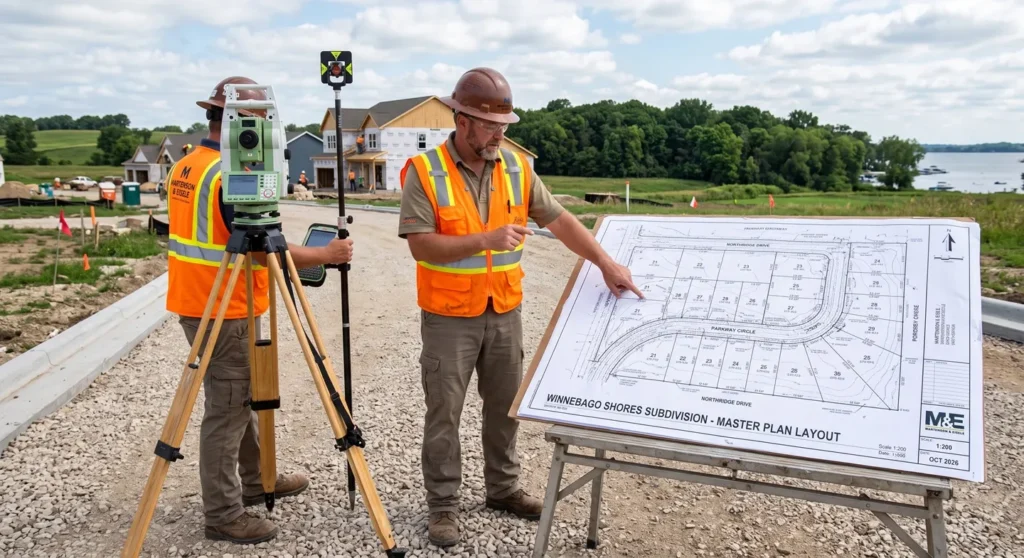
A property survey does not begin behind the lens of a tripod. In practice, a substantial portion of the effort happens long before a field crew drives a single wooden stake into the dirt.
The baseline fee covers the exhaustive legal research required to reconstruct the history of your parcel. Surveyors must pull historical deeds, original subdivision plats, public road dedications, and recorded easements through the local county register of deeds. In many older Wisconsin municipalities, this means reviewing handwritten documents and century-old survey records to verify the true chain of title.
The core professional activities included in a baseline proposal typically encompass:
- Public Records Research: Examining title commitments, municipal right-of-way maps, and adjoining landowner descriptions.
- Field Boundary Recovery: Locating surviving iron monuments, stone markers, and historical reference points across several adjacent city blocks.
- Mathematical Boundary Resolution: Comparing physical field measurements against legal record descriptions to identify overlaps or gaps.
- Deliverable Preparation: Drafting the formal boundary drawing, setting missing corner monuments, and filing required survey maps with county authorities.
The Scope Hierarchy: Matching the Survey Type to Your Goal
The overall boundary surveyor cost depends heavily on which specific type of survey deliverable your project demands. Simple lot line verifications require far less field time and analysis than comprehensive commercial transactions governed by institutional lenders.
Reviewing your immediate project milestones ensures you order the right product without paying for unnecessary field hours.
1. Basic Boundary and Retracement Surveys
A standard boundary retracement serves to re-establish existing property corners on the ground. The crew locates existing monuments, sets new iron pins where original markers are missing, and provides a certified drawing. This service works well for basic parcel acquisitions, perimeter fencing, or small additions where zoning setbacks are straightforward.
2. Certified Survey Maps (CSM)
In Wisconsin, splitting an existing parcel into four or fewer lots typically requires a Certified Survey Map under Chapter 236 of the state statutes. A CSM is a legal instrument that undergoes formal municipal review and approval before recording. The additional fees reflect municipal submittal coordination, public agency monumentation standards, and formal recording protocols.
3. ALTA/NSPS Land Title Surveys
Commercial real estate transactions involving corporate lenders or title insurance companies almost always mandate an ALTA/NSPS Land Title Survey. These surveys adhere to national standards set jointly by the American Land Title Association and the National Society of Professional Surveyors. They demand thorough field investigations to map every visible improvement, parking stall, utility connection, and unrecorded leasehold right.
ALTA surveys incorporate specific optional items known as Table A choices, including:
- Table A Item 6: Formal zoning classification verification and applicable setback lines.
- Table A Item 8: Comprehensive topographic contour mapping integrated directly into the boundary drawing.
- Table A Item 11: Location of underground utilities based on observable surface evidence and public marking records.
Site Conditions That Influence Your Investment
Two parcels of identical acreage can require vastly different amounts of field effort. A square, five-acre cleared farm field on flat ground is significantly faster to survey than a five-acre wooded parcel along a meandering river.
Physical accessibility and environmental terrain dictate crew hours in the field. When dense brush blocks optical sightlines, crews must cut clearing lines by hand or deploy specialized GPS equipment where canopy cover allows.
Key site variables that impact project timelines include:
- Parcel Geometry: Highly irregular tracts with dozens of angle points require significantly more instrument setups than standard rectangular parcels.
- Canopy Cover and Vegetation: Heavy timber stands slow down satellite signals, requiring traditional total station traverse loops through the trees.
- Age of Surrounding Plats: Older neighborhoods where original iron markers have been disturbed by utility excavations require extensive searches across neighboring blocks.
- Discrepancies in Adjoining Deeds: Conflicting descriptions with neighbors require extra legal research to resolve boundary ambiguities before setting final pins.
How historical deeds affect the final boundary determination plays a significant role in the overall project scope. For independent statutory guidelines regarding state platting practices, developers often reference the Wisconsin Society of Land Surveyors and municipal recording standards.
Practical Steps for Requesting an Accurate Survey Proposal
Securing a reliable, firm proposal starts with giving the surveying firm complete information during the initial consultation. The more background data you supply up front, the less contingency time the project manager has to build into the estimate.
You can streamline the quoting process by organizing key legal documents before requesting numbers.
When preparing an inquiry, assemble the following site materials:
- Current Title Commitment: Providing Schedule B documents immediately reveals all recorded easements and title exceptions that need verification.
- Recent Property Tax Bills: Tax parcel identification numbers allow the mapping team to pull public GIS data in seconds.
- Preliminary Site Concepts: Sharing your intended building footprint helps the surveyor advise whether you need simultaneous topographic mapping.
- Transaction Timelines: Clearly stating closing dates and municipal review deadlines ensures the firm allocates appropriate crew resources.
Aligning your boundary work with your broader design schedule early prevents repetitive field trips and keeps your soft costs in line. If you are assessing an upcoming acquisition and want to confirm site constraints before closing, connect with Martenson & Eisele to schedule our architectural feasibility and site review services.
Frequently Asked Questions
Can a boundary survey be completed in the middle of a Wisconsin winter?
Yes, professional crews work year-round, though heavy snow cover and frozen ground can add modest field time. Surveyors use magnetic locators to find iron monuments buried beneath snow, but deep frost often requires specialized rotary hammers to set new corner pins into the ground.
Why do neighboring parcels affect my boundary survey price?
Surveyors cannot evaluate a property in a vacuum. Under state licensing rules, a surveyor must verify original section corners and adjacent property monuments to prove the legal location of your own boundaries. If surrounding monuments are missing, the crew must search further down the street to establish a reliable baseline.
What is the difference between a boundary survey and a mortgage inspection?
A mortgage inspection is a low-detail sketch prepared for residential lenders that only approximates building locations relative to property lines. It does not re-establish property corners, cannot be used for construction permits, and carries no legal weight in a boundary dispute. A boundary survey is an accurate, certified legal document.